The Hike To The Mitchell Falls
I had no idea how big and impressive the Mitchell Falls are, and I had no idea what an amazing region the whole Mitchell Plateau is.
If you visit the Kimberley you really should try to make time for a visit to this area, even though it means setting at least a few days aside for it.
It's worth it!
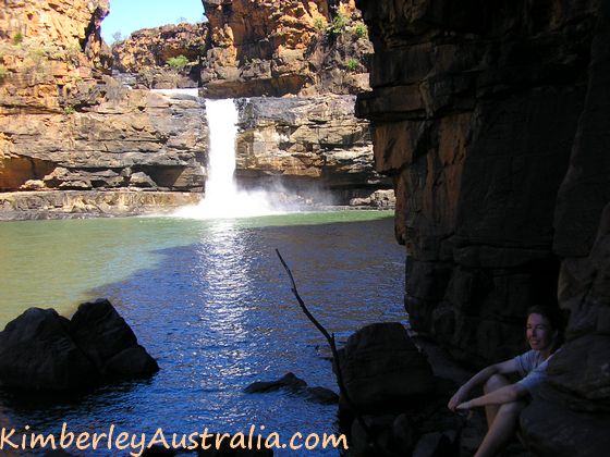 Sitting at the bottom of the Mitchell Falls
(Find out how to get to the Mitchell Plateau and more info about it here.)
On this page I describe the walk from the Mitchell Falls camping area to the bottom of the last tier of the falls, and I show you some pictures, even though they don't do the area justice.
This walk will take you 4 to 6 hours return. It's rough country and there are many sidetracks to explore on the way.
Here is just a tiny glimpse of what you will find...
The Walk To The Mitchell Falls
The walk to the Mitchell Falls starts at the Mitchell Falls campsite. At the beginning of the walk is a stand with leaflets with info about the diverse plant and animal life, even species lists for the serious nature buff and bird lover.
There is also info about the Aboriginal owners of the area, and about the rock art that you will see on the way.
And last but not least there is a route description with trek notes.
Everything you could possibly ask for.
Your hike begins with the crossing of the pretty Mertens Creek.
(This is the place where you will flop into the water for a relaxing soak in the evening.)
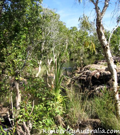 This is where you cross Mertens Creek
From here it's only about 15 minutes to get to Little Mertens Falls.
(They have actually now been renamed to Mertens Falls, and the former
Big Mertens Falls are called Mertens Gorge. We'll get there later.)
Little Mertens Falls isn't little at all! It drops quite a way, so be careful near the edge.
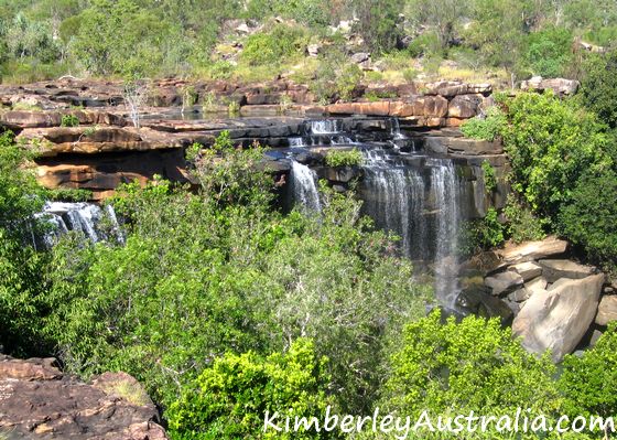 View of Little Mertens Falls
You can walk across the top of the falls to the other side. There are
many rock ledges, pools and rapids, shady spots to sit down and just
listen to the water, and natural spas to cool down in.
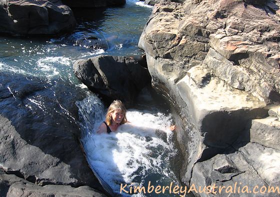 Sitting in the natural spas above Little Mertens Falls
It's a great place to hang out for an hour or two. We did so on the first day, as we had arrived in the afternoon and weren't going to walk any further.
However, the most interesting feature of Mertens Falls can be found underneath.
If you stay on the right side of the river and just follow the main track
you will, soon after climbing down a small rock face, see a path to your
left.
Follow it and it will take you to a cave underneath the falls.
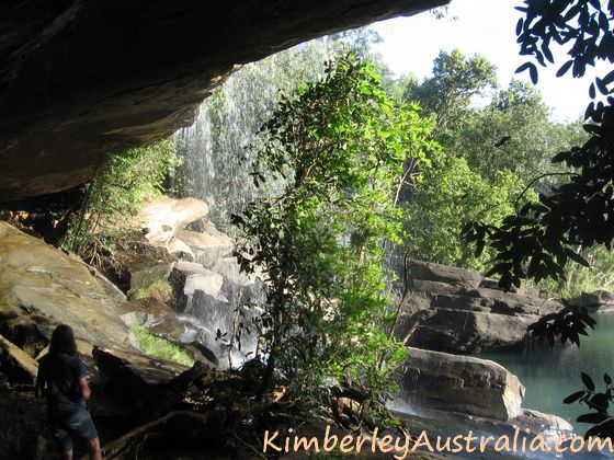 The cave underneath Little Mertens Falls
On the cliff face here you will find some beautiful ancient Bradshaw paintings.
(I am not allowed to show you photos of the paintings.)
Further in the walls are covered with delicate rock ferns. The dripping moisture has given the rocks are lovely pattern.
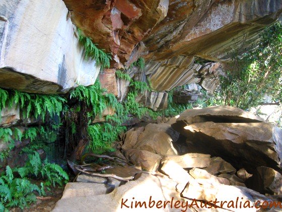 Ferns and pretty patterns on the rocks underneath Little Mertens Falls
And all the while the falls are thundering from above. It's easy to
see why this place was of spiritual significance to the creators of the
rock art.
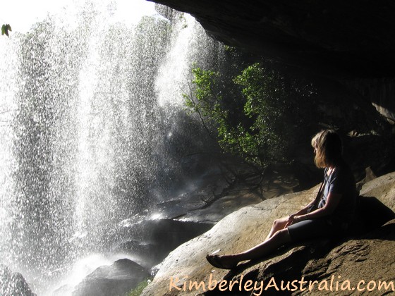 Sitting below Little Mertens Falls
Once you leave Mertens Falls behind and continue your way towards Mitchell Falls the path leads you through a shady patch of rainforest. When it opens up again you soon hear the creek to your left as there are more rapids.
If you leave the path and climb over the rock slabs down to the creek you find another irresistible swimming pool. And if you look up you see another big rock slab covered in Bradshaws.
On a hot day I'd stop here for a swim on the way in and back. It's a lovely spot, so peaceful. I could sit here forever.
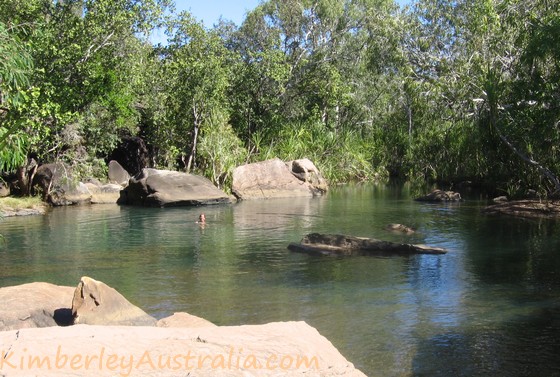 Natural rock pool on the way to the Mitchell Falls
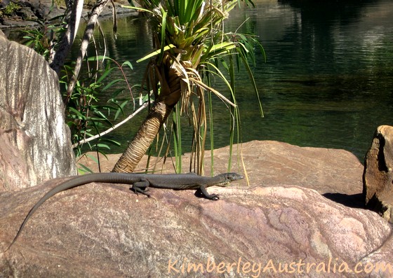 This little water monitor also enjoyed a swim and some sun bathing.
The next stop is the Big Mertens Falls, or Mertens Gorge as it's now called. Now these falls are big, though not as big as the Mitchell Falls.
If you walk along the top of the falls to the far right you get the
best view of them. But be extremely careful here, it's a looong way
down...
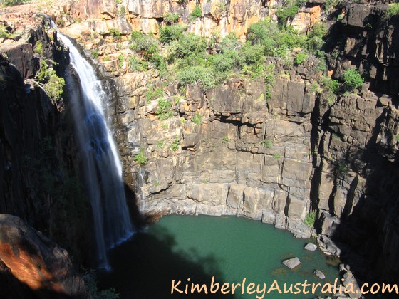 Morning view of Big Mertens Fall
The gorge below is narrow and dramatic, and impossible to
capture in a good photo. Not much light enters the bottom, but at the
top of the falls the sun was blazing even though it was only early in
the morning.
This is the view of the gorge from the other side, after crossing over the top of it. You can also see people standing near the edge on the other side of the falls:
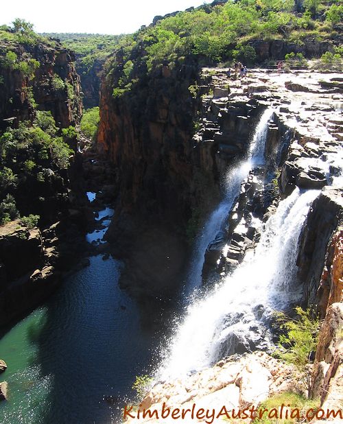 Mertens Gorge
And this is what it looks like in the afternoon when the sun is fully on it:
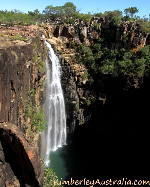 Big Mertens Falls in the afternoon sun
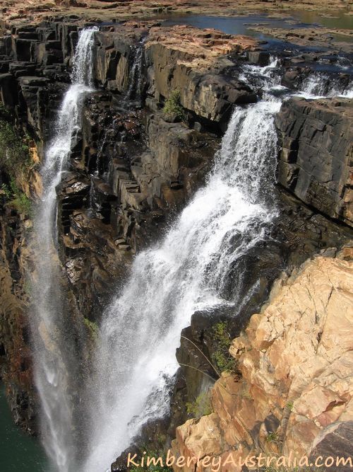 Big Mertens in its full glory
To get to Mitchell Falls you need to make your way across the top of Mertens Gorge and continue on the other side.
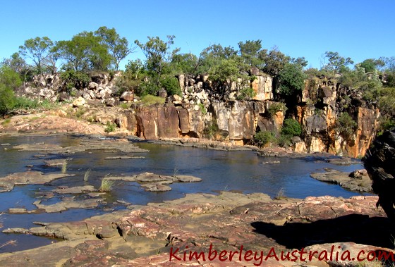 This is where you need to cross above Big Mertens Falls
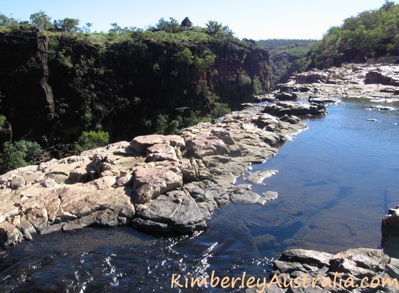 Looking back from the other side along the edge of Big Mertens
The walk gets more difficult now. It's very rocky terrain, big
boulders to climb over, clumps of spiky spinifex, loose gravel... It's
easy to slip if you don't look where you're walking, as I found out. But
then again, I was walking in thongs (flip-flops) as always. Hehe.
(You are supposed to wear real shoes.)
The Mitchell Falls are just around the corner now.
We didn't even realise what we were looking at when we first saw them, because you approach them from the top.
There was this amazing view along the Mitchell River (not shown) and a thundering noise.
If you climb up on the big rock slabs on the right you get to see what's on the other side.
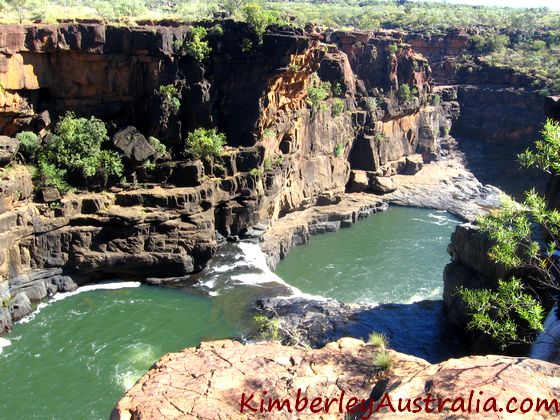 The Mitchell Falls from above
We stood there spell bound for a while, taking in the magnitude of
the view below us and wondering why no information we had read had
mentioned this fall.
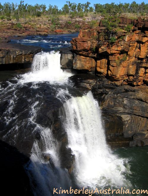 The top tiers of the Mitchell Falls
Finally it sank in that it was the top tier of the four tiered
Mitchell Falls that we were looking at. I wonder how many people
actually make the detour over this way.
The path continues around the left and you cross the Mitchell River not far from the top of the falls. Early in the season the crossing is an adventure in itself. It's wide, it's deep, and the current is quite something.
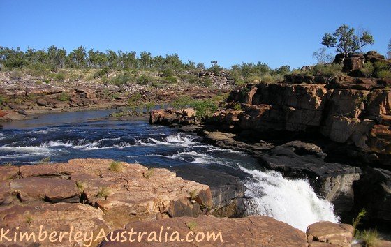 You need to cross the Mitchell River just above the little rapids.
On the other side we got lost a bit, there were no arrows or rock
cairns anywhere, but it doesn't really matter. Just make your way over
the top of the rocks and you can't miss the helipad. On the other side of the helicopter landing area you will pick up some arrows again.
From here the path is much better marked, because all the non bush
walkers that use the helicopter to get here need to be able to find
their way to the official photo lookout. :)
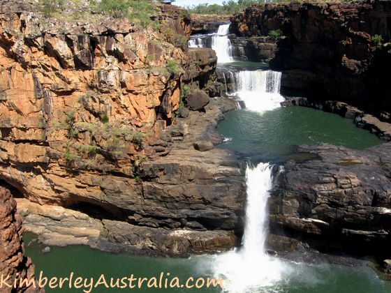 The Mitchell Falls as seen from the official photo lookout.
We even had to stand in line a bit to get to take our photos. If all
that sounds like a bit of a let down in the end fear not. There is more
to come yet...
Before you get to the photo lookout there is a path branching off to your left. If you have some energy left, follow it.
It will take you to the bottom of the falls. It's not easy to
get down there. Maybe it is easier later in the season, but we were among the first people for the year, so we had to fight our way
through a wet season's worth of growth. And in our climate that is a lot
of growth!
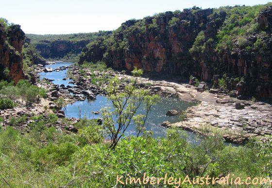 The Mitchell River. You need to climb down through the shrubs.
Thank god there are many rock cairns. At least it isn't hard to see
the way, and it's not that far either because it goes pretty much
straight down. (Another way of saying it's rather steep...)
Once you reach the bottom you will have to follow the river back up until you get to the bottom of the Mitchell Falls.
Wow. You are a lot closer to the Mitchell Falls down here than you are at the lookout. You can even feel the spray drift.
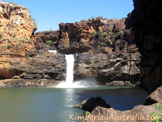 At the bottom of the Mitchell Falls
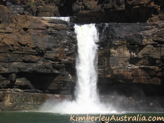 The bottom tier of the Mitchell Falls
And there won't be many people down here. When we were here the
Mitchell Falls had been open to tourists for two weeks and we saw only
one other set of foot prints down here.
We had our well deserved lunch break high up on a rock ledge, a perfect table and bench in the shade of the tall walls, with a perfect view.
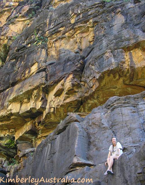 Shady rock ledge for a lunch stop
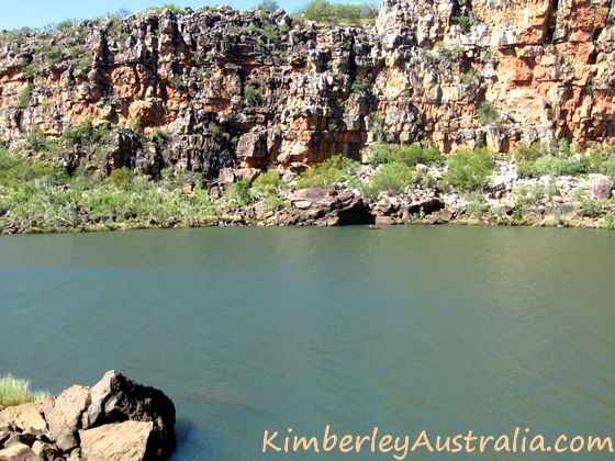 The inviting view of the Mitchell River from our lunch place.
If you are tempted to go for a swim here I have to disappoint you. Not only is this a sacred place, so swimming isn't allowed.
It's also saltwater crocodile country, and I wouldn't take any chances with those...
(Anywhere above the Mitchell Falls is safe.)
It took us about three hours to get here, but we didn't stop for any swims on the way in. We sure did on the way out, though. The return trip was done at a more leisurely pace, since now we knew we had all the time we needed. And although I was knackered by the time we got back to the Mitchell Falls campsite I enjoyed every minute of it.
My feeling is, unless you are scratched and bruised, battered and exhausted, wind and sun burned, you haven't really been there...
But if you feel the whole return trip would be a bit much you can always walk just one way and use the helicopter for the way back.
That's actually what most people do. Just don't restrict yourself to
only the helicopter flight and the Mitchell Falls photo lookout. That
would be a crime...
Mitchell Falls main page.
Travelling to the Kimberley?
The FREE Kimberley Pocket Guide
A great introduction to travel in the Kimberley region and along the Gibb. This free resource will answer all the questions you might have in the early stages of planning a trip.
Destination Kimberley
The full Kimberley travel guide shows you how to make the most of your adventure at Australia's last frontier. Destination Kimberley includes the most detailed and most current guide to the Gibb River Road available anywhere. Also called "The Bible" by its readers.
Travelling to the Northern Territory?
Destination Top End offers the same comprehensive, detailed insider information for the tropical regions of the Northern Territory. Be the best informed traveller in the Kakadu, Litchfield and Katherine Gorge national parks and beyond!
A must have if you travel to or from Darwin.
NEW! Destination Red Centre is the latest addition in this popular series. Monica Coleman takes you through Australia's red Outback heart, offering all the detail and insider tips that you have come to know and love about our guides. With special emphasis on Aboriginal communities and culture.
A must have if you travel to or from Alice Springs/Uluru.
Mitchell Falls main page.
